
Civil Engineering, Assets Management and any other discipline that requires dealing with physical infrastructure -be it a bridge, a road or a skyscraper- goes through complex workflows from idea to disposal. These require dedicated tools and software for effective management and to prevent any possible inefficiencies that can quickly translate into extra costs.
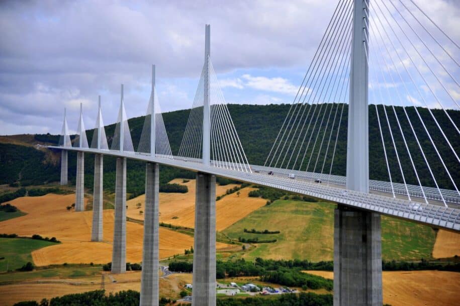
Cutting inefficiencies and speeding up the design and construction process are probably some of the most plausible reasons why AR, since the very beginning, has witnessed a considerable amount of adoption among AEC professionals. Being able to anticipate some of the most common causes of faults by visualising a realistic 3D Digital Twin preview of the infrastructure, on site or in the office, offers a lot of benefits along the entire value chain of Infrastructure Management.
Civil Infrastructures (e.g. Bridges) Visualization Use Cases
Augmented Reality visualization of civil infrastructures can help Designers, Engineers and Workers in many ways. Here is a list of the most common use cases.
- Design
- Being able to view your project in the physical space before it�s even built can help you and your stakeholders get a grasp of how the final bridge will look like and may help you become aware of potential flaws in advance.
- Participatory Planning
- Big infrastructure projects, including bridges, can require a participatory planning phase with citizens and institutions before they get the green light. AR visualization in the target site can help to better discuss and address any issue regarding the environmental impact.
- Construction
- With operations going on in the construction site, AR visualization of bridges can help to assess the actual level of completion of the project and to carry a gap analysis between the baseline and the actual infrastructure.
- Maintenance
- Being able to analyze an Augmented Reality representation of bridges can help Maintenance Managers and Field Workers better communicate and agree on the intervention points and on the activities to be carried on.
- Disposal
- Even when the lifecycle of a bridge is over, AR can help plan the disposal phase in order to have a realistic visual representation of the site and make disposal operations more efficient.
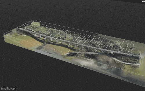
Preparing the model (3D and Photogrammetry workflows)
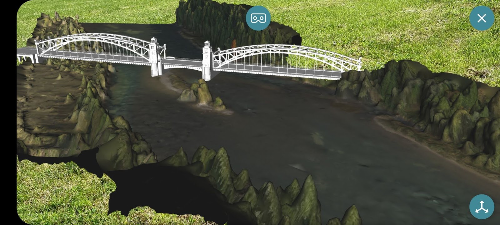
You can decide to visualize your 3D model in several ways: planar; spatial; geolocation.
With a planar visualization you can view your 3D model directly on a printed image, rendering or planimetry, while using spatial or geolocation you can see the model directly in the physical space or even in the project site before it�s even built.
In order to prepare your model for AR visualization you basically have two ways:
- Existing infrastructure
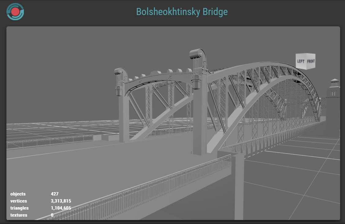
- When the need is to plan maintenance tasks on existing assets (e.g. bridges) you can either rely on an existing and detailed 3D model with textures that corresponds to the current state of the infrastructure or you can create a photogrammetric reconstruction (mostly using drones) and use that as the base for planning your operations.
- Non existing infrastructure
- When the infrastructure is still at the design stage, or the construction site is still working, you can only rely on the 3D model of the project.
Visualizing civil infrastructures and bridges with AR-media
If you have 3D models or a reconstruction of your asset (let�s say a bridge) it takes only a few minutes to create an Augmented Reality presentation using AR-media Studio.
You can either create a planar project if you want to associate your content to a target image or a spatial project if you want to be able to visualize it in the physical space (indoor or outdoor). Finally you can create a geolocalized project if you want to enable the content only at a specific location.
Get a free AR-media account and start creating, you can rely on detailed tutorials and documentation available in the support section.
